
The Minister for Public Works and Planning Stefan Zrinzo Azzopardi and the Parliamentary Secretary for European Funds Chris Bonett addressed a seminar on the SpatialTrain Scholarship Scheme project, organized by the Planning Authority, which is partially funded by the Union European through the European Social Fund.
Minister Stefan Zrinzo Azzopardi stated that he is satisfied that the Planning Authority has taken this initiative to provide more training on spatial data. The minister said that in this era dominated by informatics and communication, it is essential that information and spatial data be more widespread and available to the public so that it can be maintained and analyzed better. He concluded by saying that the training that was given along with the research that was published in three volumes, will serve both as a reference and as an inspiration to instigate more work.
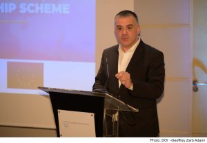
Parliamentary Secretary Chris Bonett said that “This project, with an investment of more than €900,000 financed with European funds, continued to help improve the skills of more people working in various sectors, including the tourism and the environment, and thus we continued to strengthen the public sector to lead to a stronger and more trained public sector.”
Dr. Elaine Sciberras, Project Leader, emphasized that this project allowed participants from various governmental entities to acquire specialized skills in the acquisition and analysis of spatial data in the physical, natural and social environments, through modeling and 3D simulations . This has allowed the improvement of knowledge in a range of areas such as planning, public health, transport, aviation, cultural heritage, spatial dynamics of crime, ecosystem monitoring , and water and marine applications, among others.
The project aimed to offer scholarships in the field of geospatial technology (geomatics) for persons employed in the public sector and in the public service. A total of seventy scholarships were offered at MQF level 4 (certificate), level 5 (diploma), level 6 (Bachelor’s degree) and level 7 (Master’s degree). This project excelled by bringing together a large number of entities, and provided the possibility of training to all public service and public sector employees.
This project was the first step to provide training to the public sector in the field of geomatics. Apart from the fact that digital technology is constantly evolving, public entities are increasingly in need of spatial data to address key issues such as climate change, public health and spatial data security.


